Showing posts with label map. Show all posts

Monday, December 7, 2020

A return to documenting these rides, a p*ss poor show, and I need to keep on top of it.

2020, a review and update on the progress through the year on my self imposed challenge to ride all the byways and bridleways in Kent.

I need to really give myself a kick up the arse to record this properly and capture the details at the time, forgetting the small details after the event is inevitable.

2019 ended with a slow down in riding, fell ill with the dreaded cough/cold for the end of Dec/Start of Jan, on reflection it could have been Covid related, but we'll never know.

So riding resumed on Jan 18th to start filling in the gaps in the map and the trails in the county I have still yet to cover.


I chose Yorkletts country park as the start here, free parking in the small car park, and it has good access. 

Yorkletts OS info

From Yorkletts it's wet and cold country lanes, left, and south towards Dargate, over the common and onto Denstroude Road, on the right is the entrance to the first bridleway.

This rolls nicely on a gravel surface until the start of the woods proper, then it all turned to crappy mud, and more mud, the leaves and raid and horses made for a shitty slow slog through the mire, out the other side around Bossenden Farm and out onto road. It's one of many trails through Blean woods, well worth a visit (but probably in the better weather).

Slow progress up the hill to Dunkirk, past the village hall, and towards Boughton, on the right opposite Jays Wood is the next bridleway through Clay Pits Wood. It looks like a driveway, but leads to the trail. 


This is a great short ride, muddy in the winter but a great sweeping downhill to the road. The view as you exit the woods takes in The Swale over Graveney. 
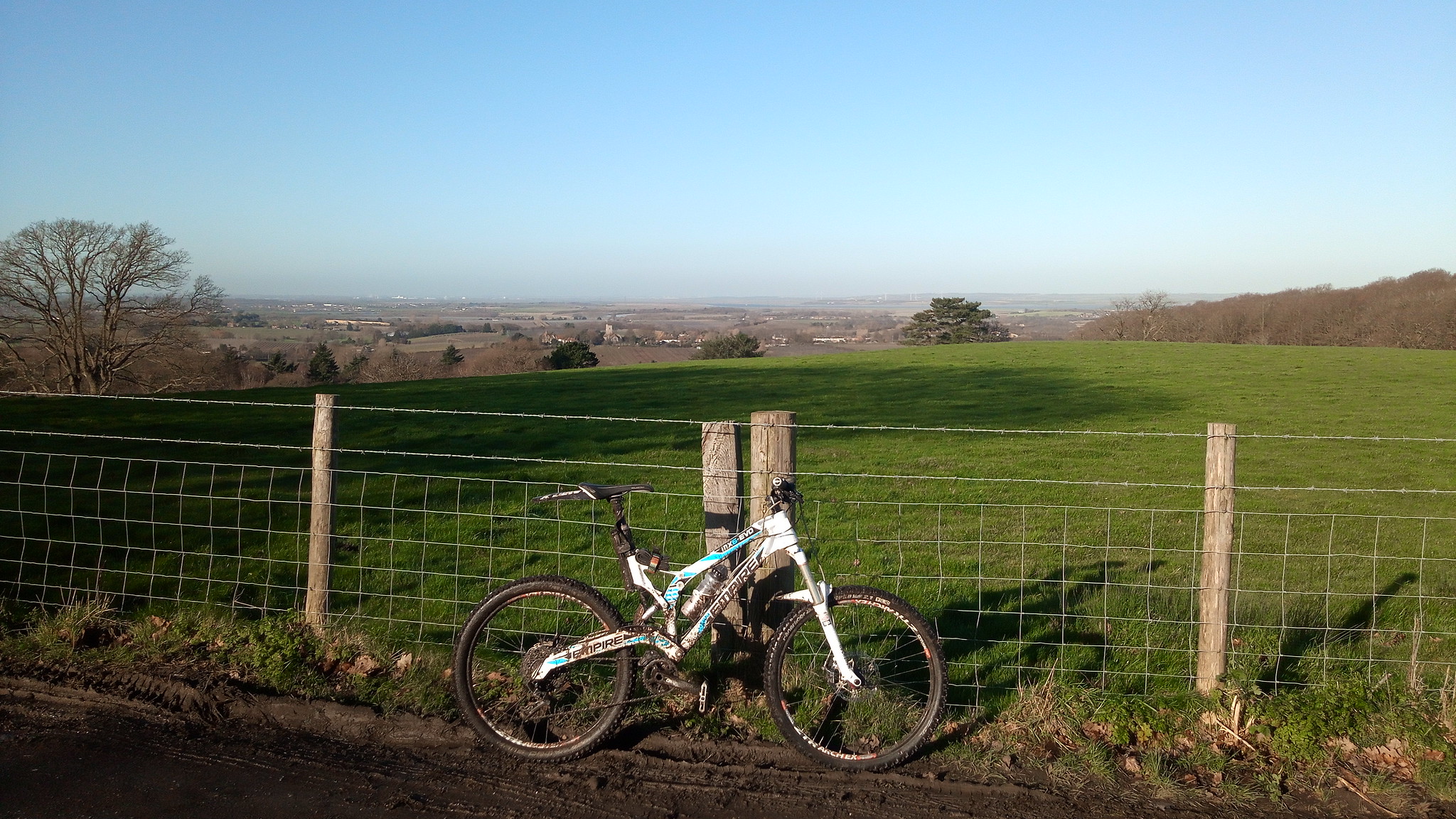
IMG_20200118_112833

From here at the road junction go straight over onto the next trail, another bridleway over Holly Hill.

Holly Hill has two bridleways, and I've covered the right hand fork previously, the left hand one takes you in a long downhill curve, at this time of year through sparsely covered trees and mud, and out onto the road. I now too the opportunity to grab some missing tiles and took a road section through Graveney and out to the coast, along the coastal path and into Seasalter, there's an odd restricted byway (Sunray Avenue) running through the middle of the town, which needed to be covered. 


It runs easterly and out to Joy Lane, then it's a trawl through the traffic and up the hill our of Whitstable, over the A299 and up Clapham Hill on the right, just past Willow Road is the next bridleway.


This one is more grassy and muddy, but a nice trail between hedges, out onto open fields and then onto the small lane at Wraik Hill, left alone the lane to Fox's Cross Road, and onto the trail leading into Ellenden Wood, I've just this section to complete the bridleways through this wood and it proved to be a git, slow and muddy and poorly sign posted.


The beginning is up a grassy, muddy field, well used by horses, and wet, thoroughly bogged. At the top it leads into the woods, and I follow this through and out (via a unmapped shortcut) to the Yorkletts park again, this was also a wet and boggy trail, with plenty of pushing and swearing, but finally back to the car park, to finish, and take stock!!
More trails covered, an incentive to get back out, and some veloviewer tiles taken too.


Saturday, October 14, 2017

Around Edenbridge, on the Sussex border.

2nd September 2017, a first run around the bridleways near Dry hill.

Looking at the progress I've made so far there was a corner of the county that had not been covered, I'd been around Westerham and Sevenoaks, and needed to get down to south of the Bough Beech Reservior.
We started off at Four Elms, there's limited parking opposite the church but it is free.
Heading north on the B269 to turn right into Mapelton Road, lovely country lane beneath the north downs, continue on this road for roughly 1.2 Km and the entrance to the first Byway is on the left.


The byway runs westerly (through a farm) over to Spout Lane, its a good running farm track.


This winds south west, on a farm track and out onto the road, which we rode westwards, Dairy Lane to Swaynesland Road, we turned left (south) onto Guildables Lane and followed this south to Monks Lane where we turned right, the next bridleway is just on the left here.


It runs as a concrete farm trail down through Bachelor's Farm, there is a junction at Troy Lane and another bridleway continues on the left, take this trail.
This bridleway runs east over to the main road, it has a few gates, and runs through a grass section, getting thinner nearer the road.


Once you appear out onto the B2026, turn left and almost immediately on your right is the entrance to the next bridleway.
This runs down a grassy track alongside horse paddocks and out onto farmland, I have to admit we lost our way a bit here, the signage is a bit bleak, so we took a guess which turned out ok.
The trail loops around to the right and onto Swan Lane, it's ok, and if you want to skip it feel free, the views over the downs are good here though.

We took Swan Lane on the right and back onto the B2026 for a slog through Edenbridge, the ride through the high street is better than the bypass, we've done both and prefer the high street.
Out of Edenbridge following Mill Hill down to the junction with B2028 at Den Cross, this is an awkward right hand turn on a left hand bend, so take it steady.
This is Marsh Green Road, and the starting point of a few bridleways, the first is on the left at Shernden Lane.


This is more of an adopted driveway to be honest, tarmac and a bit of a disappointment, however it does get better (more on a later ride), for our firt foray we turned right onto another bridleway that essentially takes you out onto the road again.
Here we followed the road down to the next bridleway entrance:


This again starts out as a driveway/track and runs down to houses, before leading onto the nature reserve at Dry Hill. (Site of an Iron Age Fort).

We rode a few of these, covering more on a later ride, check out the OS Map, OS Explorer 147 to get an idea of the area, but there are some great trails here, through the woods.
Heading East we rode through Crippenden Manor and out to the road at Spode Lane, then turning left onto Hartfield Road, heading North to Hever and Hever station.
After crossing the railway at Hever, we headed left, then right, down to the river and towards Hever Castle, and turned left onto Hever road, following this for about 800m, until the bridleway entrance on the right.


At the time of riding this was overgrown and full of nettles, giving us a gentle reminder of the joys of bare legs. It's a good trail, crossing the river on a foot bridge and runs for nearly 2km, of singletrack.
This last stretch was back onto the road at How Green Lane, and returning to Four Elms.

The area around Edenbridge and Dry Hill is great for a ride, we could reduce some of our road times by changing our starting point etc, but I'd recommend checking out the trails here.


Tuesday, October 25, 2016

Hardcore around Hawkinge..... another Kent loop out.

Hawkinge, Kent.
Rule No. 9 for this one....if you are out riding in bad weather, it means you are a badass. Period.
Velominti - rules. 
It did rain, and rain, and then just when we thought it stopped, it rained again. 

Continuing our quest to cover Kent, we had our second route out from Lyminge, this time heading East and down to the Channel Tunnel terminal, around Hawkinge.

From the village hall car park in Lyminge, we headed back through the village and on to Station Road, turning right towards the village welcome sign. On the left is Greenbanks and, between the doctors surgery and the road is a track that is the start of the byway out of the village, this is a steep tricky ride, concrete and old tarmac up to  a muddy trail.
(sems popular with motorbikes).


It heads out to the south east between brambles, a good trail, alongside the golf course, you then exit onto Teddars Leas Road, which we followed around to the bridleway start on the right.
(its about 750 yrds, at the Shearins Bungalow site)


A good route, between fields, tree covered and dips down at the end out onto the road. Here we turned right, down towards Peene, its a quick steep descent with a sharp left hander at the end, leading onto the bastard that is Danton Lane.
This road runs alongside the channel tunnel terminal, it was wet now, really pissing down, and quite frankly miserable. But in an odd way I enjoy the crappy weather and my waterproof sock full up with water make for hard pedalling. We took the right hand fork on the junction at the top of the hill onto Crete Road West, this is a great lane, up over the terminal looking out to sea, with the channel a grey squally mess. 
Following the lane along further it dips under the main A20 and then out to meet the busy A260 Canterbury road, some rather shifty crossing skills got us over the road.
Crete Road East now climbs at about 12% up onto the cliffs above Folkestone, we follow the road here for half a mile and just past the houses opposite the closed lane on the right, is an unadopted road on the left.
This is according to some maps "Cut Throat Lane", a good ride across open fields (a white lane on OS maps, always a mystery those!), leading down to join the Alkham Valley Road. 
By this time my makeshift OS map was getting a bit soggy, so we headed right along the road, to find the next section of offroad. 
With the weather still terrible, and quite fun really, we (well I) totally mis-judged the distance and we ended up taking an early exit on Standen Lane, this led us confusingly towards Hawkinge, where I lost my bearing a bit.
However, at the village the sky cleared, I managed to fold the wet map and get it into my pocket, now resembling a tissue after a trip through the washing machine, it would be used only in dire need.
We took another couple of turns through the village missing my intended routes, and taking a cheeky footpath we finally got back on track, the footpath goes through the woods and out past horse paddocks down to a roundabout at Milgate Farm. 


The footpath exit brings you out next to the entrance to the cricket club, and we were back on track, taking this lane leads you up and into the woods and onto the next bridleway, at the right hand corner just past the club is the start. This is a lovely trail through Reinden wood, heavy usage by horses, but flat and wide through the woods. We exit at the end of the woods and head out onto the bridle way north east across the fields towards Swingfield.
Onto Boyinton Lane we turned left and followed the road out to the junction with the A260, and onto Reece Lane.
We turned left  right heading back on our loop now, onto Hoad Road, following the lane until the next bridleway, at about a mile the road bears to the left and the bridleway is on the right. (the trail straight ahead is a byway).


Here it runs down into a wood to a gate, and then into an open field, up and down a dip and back alongside the woods to the exit on the right, some parts are awkward grass covered tracks. 
Out from here onto Ridge Row, we rode straight down to Paddlesworth to join the next off road section. This is another bridleway heading west. 


This is another great flowing bridleway between a hedge and fence, down and across a field to a complete mystery, no regular traffic, or signs of horses. walkers etc, so using our best judgement we just headed for what looked like a lane on the far side of the field, it's a shame when this happens and you feel a bit of a failure for not picking up the trail, or working out where it should be.
We found the end......

and then the start of the next one on the other side of the road.


This is our last bridleway over fields heading back to Lyminge, its a good one, grassy and flowing, a few gates to get through and a section through a farmyard and down through a wooded section, there is a nice long downhill section at the end running to the village. 

And we're back... despite the weather, it was again great to be out seeing more of the county. 


Friday, September 11, 2015

Mystery tour, loop out from Biddenden.


Free parking in Biddenden village centre.
From the car park we headed south on the A262 and turned left onto the High Halden road, getting the legs spinning and warmed up on some tarmac. We followed the road past Turks Head Farm and to the entrance to the Byway listed as Gore Lane. It's a wide trail, running between trees, and ends up as a tarmac drive way past a farm and out onto the road.
This is the lane to the north of High Halden, we turned right here and the the first left onto Wrens Nest Lane ride this to the end and then turning right onto Hookstead, and then down onto the A28 (turning right, heading west).
On the A28, watch for traffic etc. and the restricted byway entrance is poorly signposted and looks like a drive to a house, it's not, and its about 100 yards on the left between two houses.
There's a gate at the start and then it winds down through the trees and stops, leading onto a driveway and out onto the lane. Here we made a cock up and went right, but we should have gone left, needless to say, one long loop around and we found the start of the next bridleway. 
Ride East along Harbourne Lane cutting through Pond Wood and Herontoll Wood, at the next right hand bend the bridleway starts. To be honest I'd avoid this if I ever went back, it's not sign posted and following it is a nightmare. We ended up asking someone if we were on it when it felt like we were in her garden. She was understanding and pointed us in the right direction, turns out it does go through some gardens and landowners are not keen to show where.
Anyway, we finally came out onto Redbrook Street, and turned left, following this over Plurenden Lane and up to Chequertree Farm and then left over to the A28, a quick left and then right takes you onto Green Lane, single track tarmac with a dead end sign. This leads you onto the start of the next byway labelled Gadsby Lane on the OS Map.
Its a well maintained trail, around the woods, and out onto PotKiln Lane. 
Between Dent's Farm and Brickhouse Farm on the right is the bridleway entrance, the last one for this loop, it's signposted and gated.
But. this is a mystery tour again, no route marked out in the field, we rode staight across the cornfield following the line of the path. Messy and unclear, it was a bit of a crappy end to the loop.
Back on the road and heading back to Biddenden, along Pook Lane and Cot Lane back to the A274 and the car park.


Tuesday, February 3, 2015

A ride out from Biddenden

Saturday 31st Jan 2015, a loop out from Biddenden via Sissinghurst, Kent.


Parking at the car park in Biddenden village we headed out south on the A262, Tenterden Road, at the junction with Benenden Road, on the left is the entrance to the first byway, it looks like a gravel drive (which it is, at first), but leads onto a hard packed trail. It's a flat pull through to Fosten Lane.
At the end of the trail turn right and head south, we are going towards Hemsted Forest so follow the lane to Cranbrook Road, and turn right here. This is a fairly busy road, watch out for traffic, they had a tendency to overtake. Turn left on to Mockbeggar Lane, follow this all the way to the junction and then onto Benenden Road again, still heading south. 
This leads onto Goddards Green Road, but the bridleway is tucked away on the right this is the start of the run through Hemsted Forest (Forestry Commission land).
Its a good bridleway, hard packed in places with some muddy sections, some of the signage is a bit suspect, so we ended up missing the path and heading through the woods on other trails, this is a good area, with some interesting looking trails to each side, we will return.
At the end of the woods the path ends on the Cranbrook Road, turning left here we're heading west towards Cranbrook, about 500-600 yards along here is the entrance to a footpath, this was a cheeky cut through to keep things less "road", it heads north up through some woods (a tight squeeze in places, over a small bridge, some more woodland and onto the Sissinghurst Road (A262).
We're now heading west again and towards the entrance to Sissinghurst Castle, take the road on the right and follow the driveway up to the castle, the bridleway follows through the yard and out around the grounds, there is a view of the towers and in the summer I can imaging a good quick ride, in January, however, its a muddy drag, with a small slippery climb up to the road.
This is Bigdog lane, our loop comes back this way later, turn left here, and follow this down to the houses on the left. Here is the second bridleway its muddy and slippery and has a short tough climb out to the road. 
The intention here was to head up the A229 north, to ride the restricted byway at Brewers Wood, this again caused us some issues, and we ended up on a footpath and past a large chicken farm....
So that will be left for another trip.
Out onto the A229 and a shortcut via a footpath to the Frittenden road, this is a twisty path with a number of stiles and fallen trees to contend with, to be honest if you were walking it would be fine, but we were using it as a shortcut and we paid the price!!
Now we are heading back to Biddenden via Bigdog Lane it should be very simple, but we had an issue with a sign post.... and went the long way back!!


Wednesday, December 17, 2014

Another route out from Bredgar


Saturday December 13th

Trip out from Bredgar Kent, via Doddington.

We parked at the church in Bredgar, and set off north towards the M2, after crossing the motorway and follow the road to the left and up to Dove's Croft, the first bridleway is up on the right, it's essentially a farm track to Ruins Barn Road, once there turn left, follow the road, past some houses on the right is Cromer Road, Take this and follow it to the junction, here on the right is the bridleway entrance, this leads up to Cromer's wood, there's a dodgy part through a farm yard, where the bridleway has been blocked, but follow the edge of the orchard up to the wood (it's a grassy slog but worth it). At the edge of the wood the KCC have sign posted this as a restricted byway (the purple sign!).
Follow this through the wood, it's a good trail, slippery in the wet, but wide and clear. This leads out onto Bottom Pond Road, turn right here, then take the first left, and carry on down to the M2. Cross the road here and follow this road left then right, on to Slough Road.
At the left hand turn, the bridlewa is on the right, this is a muddy, grassy track, that follows the line of the M2. the track then turns right over the motorway and down onto a farm track.
Turning left here, onto Down Court Road, follow this and turn right onto Chequers Lane and down into Doddington, turn right onto the street, and then left onto the Old Lenham Road,
At the first fork in the road take the left hand lane, then follow this through Borden and Hazel woods, then take the left hand lane, and the entrance to the Oakenpole woods bridleway is on the right. This is a great trail, wide farm track, through the woods, then up a short climb to open coppiced land, and finally out of the woods.
A quick right and right again leads out towards Limekiln Woods, on the left. This is a swooping downhill along a muddy bridleway, at the bottom of the hill is a gate, and this leads across a pasture (normally filled with sheep!) and back into the woods.
Back on the Old Lenham Road, we took the small Byway that links this to the Faversham road, (this is underused and overgrown, hard going), then a naughty dash through the footpath in Wichling wood to bring us out near the entrance to the Coalpit Lane byway, (this is better taken the opposite direction), its a slog of a climb up a stony/flint ridden trail.
Then we followed the tarmac through Frinsted and back to Bredgar. 


Friday, October 17, 2014

Loop out from Ightham, more byways and bridleways

Loop out from Ightham, more byways and bridleways

10:31 on Friday, 4 July 2014    18 miles, 2100 ft climbing

From the car part at Ightham Village hall (free parking), we take the route to Oldbury
Hill, (see previous posts for this), and up through the woods then out and over the
A25 and around Raspit hill, taking the bridleway along the hill top through Raspit woods
and then redhill wood, these are great sections if you keep left or right of the actual
trail and take the detours.
It's a good flowing set of trails, with a great downhill at the end onto Grove Road.
The aim of this trip was to get out to see some of the trails I'd not visited before, so
I took the road down to Godden Green and found the entrance to the bridleway past the
pub, its on the left, and at the end of the drive to the hospital/clinic.
Its a good farm track, leading out along the woods and out to the road.
Here I took a left to Bitchet Common and then out to Fawke Common, the restricted byway
runs from the common out to Carter's Hill, and is a good run, nice and long and varied,
all the way down to the A225.
A quick dash along the B245 to Bank Lane to head back up towards Underriver, to take in
the bridleway at One Tree Hill, this is a nice trail through the woods out to the road,
on the right just out of the exit of the trail is the next on a long track and trail over
the fields towards the national trust site at Ightham Mote, here you ride alongside the
house and get a good view of the gardens too, up to the hill.
On the left is the next trail, a gravel track, nice and steep with plenty of spinning
wheels, out to the road back at Raspit Hill, this bridleway is very steep, and nothing
but a push was possible.
Then we're back through the woods and out to the A25 and back to the car park.


Longfield, Pilgrims way loop

Longfield, Pilgrims way loop

11:25 on Friday, 2 May 2014


17miles - approx 1200 ft climbing.

This loop begins from the car park at the St Mary the virgin Church on the
Longfield to Fawkham road, (Free parking).
Turning left out of the car park you head towards Fawkham on the very nasty
lane, be careful of cars passing as it's a bit narrow, and not quite enough
room for passing traffic.

Follow the road towards Fawkham and take the left on Micheals Lane up the hill
towards New Ash Green, these are small lanes, single track, and quiet.

I followed the Ash Lane along side the village and out towards Stansted, there is
a byway on the left this is a good trail, (I've covered this in a previous
blog) singletrack, through the hedge borders in the field and at the split I took the 
bridleway out to Hatham Green Lane, the route is grass, and a slow ride.

Then its a left onto the lane and a right at the junction onto Parsons Lane, and
another right onto Plaxdale Green Road. This is a long slog along the lane towards the
A20. At the junction turn left on the great named, Labour-In-Vain Road and follow it
to the end, it slips into a bridleway. Broken tarmac, large flints and fallen trees
were the order of the day when I rode it. The trail ends at the A20, which you need
to ride down to the bridge on the right.

Cross the bridge and head left downhill towards Wrotham, take the second right onto
the Pilgrims Way, this section is gravel and solid, a good ride leading onto the road.
I took the second right hander onto Cotmans Ash Lane, and should've paid attention to
the contour lines, it's a bit of a sod of a climb up the hillside, at the top on the
left hand bend you get a brief spin along a byway, (surface is a bit poor, but an
interesting ride).

You end on Tinker Pot Lane, (another great name), follow this to the right, and onto
School lane heading back towards the A20 and onto Fawkham, and then back to the start.


Loop out from Longfield

Loop out from Longfield 11:30 on Saturday, 26 April 2014


19 Miles, approx 1400ft climbing.

This loop begins from the car park at the St Mary the virgin Church on the
Longfield to Fawkham road, (Free parking).

Turning left out of the car park you head towards Fawkham on the very nasty
lane, be careful of cars passing as it's a bit narrow, and not quite enough
room for passing traffic.

Approx a mile along the lane take the left on Scudders Hill, this is a cheeky
hill that creeps up the side of the valley and can catch you out early on in
the ride. Stick with it.

Over the apex and just down the other side on the left is the entrance to the
first byway, this is a muddy but well maintained and follows the line of the
ridge southwards. Leading out onto School Lane, turn right here and head downhill
towards Horton Kirby, turning left on Lombard Street towards the A20.

A quick dash down the A20 on the right, and then a left onto Eynsford Road, and
ride into the village, keep riding along this road, until you see Priory Lane
on the left, take this and it becomes a byway, at the time of writing it was
closed to vehicle traffic, but it is a good open ride over the hill to
Beesfield Lane.

Beesfield Lane is back to a single track road, and a pleasant ride, follow this
lane and it becomes Maplescombe Lane, on the right at the junction to Botsom Lane
is the start of the bridleway, this heads up the hill and into the woods, the first
section is full of stones and overgrown, at the gate halfway up it turns sharp left
and up a small slope, be ready for it! Once on this it's back to a single footpath
type trail up into the High Castle woods and out onto Cherry Tree Grove. The track
through the woods is ok, but very muddy in places with diversions into the trees at
the side. Stick with it, it ends, out of the woods over a low (horse) gate, and onto
a tarmac road.

We're then back onto tarmac and following East Hill Road, past the farm on the left
is the entrance to the next bridleway, well signposted, it starts as a farm track and
reduces down to a single trail (well used by horses).
This kinks to the right and starts downhill, be carefull here, the downhill section at
the top is a set of steps (best attacked on the left hand side), once you've takled
these it's aquick run down the hill and through the barrier at the bottom onto
Knatts Valley Road.

Opposite the exit take Knatts Lane, and then the left had entrance to the next
bridleway, this is a strange one, a steep concrete path through overgrown hawthorn,
(I ended up pushing the bike) leads out to a good trail through the woods to over
Kingsingfield Road and into Stacklands wood, finally meeting School Lane at
"the Grove".

Turn right here and follow School Lane. The entrance to the next restricted byway
is on the left and is a bit odd, starts out at a trail along a fence and between
gardens, and then loses it's way a bit over gates and a field, not really a good
route.

It ends when it meets St Clere Hill Road, and we turn left here, and head south.
Knock Mill lane runs across the top of the downs, with great views and we follow
this and take the junction to Exedown Road, this drops down the hill towards the
road to Wrotham, as the lane heads left there is a sharp right hand turn, the entrance
to the bridleway is here and runs back up the hill, its steep and full of large stones.
This makes for a bit of a slog up the hill, but takes you over a bridge across the M20,
then over the field to the A20. (it would be better coming the other way!).

To wrap up the loop, I headed back along the A20 to the Fawkham road and then straight
back to the start.

A good ride out with some surprises, and again more great trails.


Saturday, March 22, 2014

Loop out from Challock, and around Kings Wood.

Another great spring day, sunshine, scattered cloud, and showers, brilliant.

So off to Challock in Kent, I parked in the Post Office car park and headed out right along the A252, towards the roundabout. Taking the left hand exit and about 400 yards on the left is the entrance to the first bridleway, muddy in sections and with a dip in the middle it was a good start.

At the end of the trail, following the road to the right and down to the next bridleway on the right, this is a great ride up through a field and through two gates and into a wooded section, paths are covered in brambles to its a bit of a trial to get through (in shorts my legs suffered a bit!). Once out of the woods and through the gate, it becomes a farm track and out onto the road. This is the Faversham road, turn right on this road and head towards Shottenden, before you get to the main road there is a byway on the right, just opposite Oast Lane, (which is the second left).

This trail was "tripletrack" in places like the London Underground, with standard 4x4 ruts and a motorcycle one in the middle. It was firm and flinty and then descended into a muddy mess at the bottom of the hill, keep in the centre of the trail to avoid the huge ruts. The route then climbs up into the woods, this is much better, and a great ride.
At the end it becomes a tarmac road out onto the main Faversham road.

I skipped across here onto Pested Lane and followed it all the way down to the A252, at the junction I'm sure there is an entrance into Kings Wood here, but I bailed and took the slog along the main road to the Dane Street Hill Byway. This is a repeat section of the route from last week, but I needed to do it again to get to the byway that runs the length of Kings Wood south side.

This trail is great, a good steep winding climb through trees with a wooded section at the top, derailleur issues fooked the climb for me so I settled for a walking section to sort it out.

At the junction I took the right hand turn and headed along the outside of the woods, this is a great trail and one I'l be back to do when the bike is better! Long stoney sections and muddy potholes with diversions!. It reminded me of the Boxley top trail but longer and more varied, I can see why the woods are a regular haunt of the SketchyMTB crowd.

At the end we're back on tarmac and the long slow drag up White Hill and back to Challock.


Friday, March 14, 2014

Day Off, great ride, great trails, say no more......


Chilham Kent.

From the free car park, its out on a sunny Friday, to ride some more of the trails in Kent. From here its out to main road (A28) and turn right, about a mile along the road on the left is then entrance to the first bridleway. This is a long incline up through orchards, and a good start.
Then at the road its left towards Shottenden and turn left into the farm (sign posted a dead end), but this leads onto the first byway of the ride, there has been some growth on the sides of the track over the winter forcing motorcycles to dig a rather unpleasant rut in the middle of the trail.
But this does wind its way down to the A28 and is a great descent (there are some handy detours to avoid larger puddles), I wish I rode this way more often as I'd know the right line to take on the trail, but no mishaps and no flint damage.
Once back out on the A28 turn left again and follow the road, on the right is the entrance to the second byway, and this is a great climb up through the woods, (Ridge Wood, and Felborough Wood), when you reach the top the downhill is most welcome, and it ends a the start of Mountain Street, which I follow down into Chilham village.
I followed the road signposted to the station, and took a sneaky foot path over the river Stour, to the restricted byway on the other side of the valley.
This has been treated well by the KCC, hardpacked gravel path, all the way along the Stour valley, alongside the railway. Its marked as a footpath on the map, but is now a cycle/horse route and is good.
At the end I turn right towards Eggerton and up and over the hill on the bridleway, which in one part seems to go through someones front garden. At the end its another left turn and onto Sole Street and follow this up the hill, left corner, right corner, small climb and another Byway on the left. This trail is closed to traffic Oct to Apr so it's in good condition, a short climb up through Barton Wood to Penny Pot Lane.
The next bridleway is on the left a short muddy section through the woods, a gate into a paddock, and another on the exit, then a singletrack between two fields and onto a junction of footpaths, at this point carry straight on but keep to the left of the woods, the next gate is down the trail. Now its through Sprats wood, back towards Chilham, out onto a short section of Mystole Lane and we join the restricted byway back to the Stour (and the footpath).

A great ride, sunshine, drying trails, and a wonderful part of the county.


Sunday, January 12, 2014


Clear skies, winter sunshine and the chance to get some of the older routes mapped out.
It was still very muddy in places but a good ride, with some great trails.

Starting from the car park at Ranscome Park, I rode over the M2 bridge to the North Downs way that runs parallel to the Euro rail line and the M2, it is a good tarmac and type 2 trail, leading to the Bridleway that climbs up through Monk Wood to Common road on the top of the Downs over Chatham. It is a great and well looked after trail.
From there I dropped down onto the byway on the right, that heads towards Burham, this is now deeply worn and water damaged, chalk, flint and some "interesting" downhill. It stretches out then at the bottom to meet the Rochester Road, and tarmac part of the pilgrims way in Burham. At the junction with Rochester Road, head straight over to meet the off road part of the pilgrims way, byway.
This is obviously a busy section well worn and very muddy, at the end turn left and head under bluebell hill to the trail behind the shell garage.
This is the continuing pilgrims way, slippery, muddy and covered in huge puddles, but a good ride if you can avoid dog walkers! Its a good roller coaster leading to a tarmac trail and out onto the Boxley hairpin. Straight over here towards the pilgrims way on the turning on the left.
At the junction near the Detling sign, is a byway on the left that climbs the Downs up to Hermitage lane, its a great climb long and slow and after the recent rain is worn and muddy, making it more of a challenge, (many of these routes I've done in the poor weather I will be back to do in the summer).

Just before the end of the lane is a bridleway on the left, this is a classic trail from Detling back to the Boxley Road. It's a smooth gravel trail but again the weather and horse traffic have not been kind, my rear cassette here filled with thick mud and slowed me down, but it is still a good ride.

Crossing the Boxley Road onto Harp Farm Road, follow this small country lane, to Bell Lane on the left, this starts as a normal road and is marked as a dead end, it's not.
There is another byway at the end that leads back down towards Blue Bell Hill, its again rain washed and chalky and flinty, with concentration needed to avoid the slippery parts.
At the bottom I turned left onto Warren Road and remember quite soon why I dislike this road, its a steep climb and made harder by the bike being covered in crap and grinding its way
up the hill, there are deceptive corners until you reach the top.

At this point you'll join Mill Lane, and cross the road onto Common Road, and pass the trail you came up earlier, keep on this road to the end (it becomes Hill Road), and there is the final Bridleway on the right at the last left hand corner, this is a great sweeping downhill passing Shoulder of Mutton Wood, great singletrack over roots, and out onto an open trail through the field to the gate near the Euro Rail track.

Here, you're on the downhill to meet the North Downs way that we covered on the way in, back along the road, over the M2 bridge again and its all over, nearly 20 miles and most of it off road.
#bike, #bridleway, #byway, #garmin, #gps, #kent, #map, #mountain #biking, #strava,


Sunday, January 5, 2014

after all the rain of the past few weeks there is no hope of an easy route out at the moment. I went out to cover some old ground I hadn't recorded from last year, and add in two new bridleways into the ride.

From Camer park, out onto the road back towards Sole Street, the first bridleway is on the right about 500 yards along the road. It starts as a gravel farm track, nice and easy and then cuts sharp to the left onto a muddy rutted, and heavily used ride. But it is downhill and a good ride down to the road out by "The Cock" pub. Turning left I'm heading back to Sole Street and then over towards Longfield hill via Round St. and left onto Copt Hall Rd.

The next bridleway is on the right, and loops around to join the main Wrotham road, its a great trail, and will be excellent once we have a drought and hose pipe ban, to clear some of the water away.

Turning right and left through Longfield hill down to Nurstead Lane and onto Longfield road, turn right towards Meopham the next bridleway is on the down hill on the right hand side. This promises to be a great trail, but is one of the worst routes in North Kent, its thick clay mud, with loads of horses using it this is almost un-rideable in the wet. My bike was clogged to the point the wheels wouldn't turn!

Once I tried to clean some of the mud off, the rear derrailleur got choked and bent the rear hanger, a quick and dirty bend and pull to get it working was needed. My gears now limited and not wanting to do any more damage I turned back and headed to Camer.


Monday, December 30, 2013

Lenham, Stalisfield Loop, the last ride of 2013

Great winter sunshine and a clear day, and I'm off again to Lenham for another bash at the trails around the downs. From the car park behind the Dog and Bear, Lenham, its up to the A20 and then onto the Doddington road, the pilgrim's way crosses this road so we turn right onto it and along in front of the war memorial. That part is open grassland, and then it dips down into a tree lined track.

After the recent storms its suffered from a few fallen trees. Its muddy and slick with chalk and clay, but a good start, the trail crosses the Faversham road on a slight hill and you pick up the pilgrim's way further up the lane, this is a great track (although slippery and muddy with heavy motorcycle and 4x4 use), and is open on the right hand side looking down towards the A20. Just past a few houses on the left there is a byway that rises strait up the hill, this was a complete shit of a ride, trees across the track and no grip, had to walk and carry the bike. 
At the top of the hill the trail levels off on to the road, I turned right here, and followed Waterditch road to the byway on the left, this is the other end of the trail from my last trip out to Lenham and is a good farm track, dual tyre tracks (sometimes rutted), leading to a hedge lined trail (brambles are growing into the path), it leads on a pleasant descent to the junction with the old railway track byway, up the hill over the crossing, and we're back on the road. From here I followed the Ringshill road, to the left hand turn onto Stalisfield road, the bike was getting heavy with mud and the new DIY front mech cover was struggling to keep the mud out. 
The bridleway entrance is on the left in the valley, the signpost from this direction is a little hard to see at speed and I missed it. But once back on the route I was not disappointed, this is a cracking trail through some open fields (2 x gates) and down into a small wood (Bowl Wood, Kennelling Wood and out into Spuckles wood), at the end the path forks with a footpath going to the right, take the left fork, it goes slightly uphill to a trail across the field. 
Through another gate and cross the Hillside Road, to continue on the bridleway through to Church Road, the trail is a farm track with a great small descent through a wood to the road. Turning right at the road junction there is an entrance to the next bridleway about 200 yards up the hill on the left, this is a bit of a treat, a wide open grass valley crossing, up the other side of the valley is another gate (see view from the top in pic), this leads through a small wood, and out to a farm, and we are back on the road again. 
This was the last trail for today, time and energy were running out, a month out of the saddle and the excesses of Christmas taking a toll. I will be back to finish these off soon, and will also return when it's dry, as some of these need a return visit!

Thursday, November 28, 2013

Cycling: Lenham Loop

This turned into a bit of a two-parter, flint puncture, then the GPS stopped when I turned the bike over, doh!. However, this is a good loop and with a bit more time I'll extend it out to the pilgrims way. I started from the Dog and Bear car park in lenham, up over the A20 towards Doddington on the Faversham Road, then left onto West street and up past Ashdown to Ashdown Hill. At the T-Junction the Byway is opposite and it goes up Timbold hill, a typical 4x4 carved out start, with a grass middle leads to a wooded area covered in stones mud and leaves, a good hard climb to the top then turn right along the road. The second Byway is just down on the right where two cottages sit, this is Coalpit Lane towards Wichling, this is a good downhill, heavy horse use at the time of the ride. Then out onto the road and turn left, then take the first right and then left at the crossroads, there is a bridleway a couple of hundred yards along the road on the right. This is a great small track down the hill, once at the road I turned right towards Sprats hill, up the Hill just past Solomon's Cottages is another byway (on the right), this is a good short downhill with a couple of sweeping turns. At the end of this is the start of the bridleway through King's Wood, a promising trail that leads through a wood onto a soul destroying grass field, and then through another gate to a climb up through the woods to the road. (Another puncture stopped me carrying on, so I fixed myself up, and headed back down to Lenham), ready for another attempt.

Saturday, October 19, 2013

Ok, we're back in the zone, after the excitement of a new car last week, I'm back bagging bridleways and byways again. This time I've moved east in the county and headed out from East Malling, to run through two byways and link up some bridleways on the way. The loop started out from East Malling station car park and headed south, down on Rocks Road to the first byway, it starts as tarmac and then diminishes to concrete and finally muck and mud and out onto the road. A short ride along north pole road to the bridleway on the right, down to the A26 and then a dog leg left and right onto the bridleway behind Barming church. A quick dash down to the river and cross on Barming bridge, with a climb out of the valley up to Kettle Lane, this feels like a drag and to be honest I'd like to go back when its not raining! From here its along Heath Road and left, about 300 yards on the right is an entrance to a bridleway cut through the woods, good firm surface with little horse traffic, and out onto Upper Barn Hill, a quick right and take the bridleway that runs alongside the White House pub, and parallel to Hilltop Road. A great bridleway leading to a cracking byway, a short muddy climb leads to a brilliant downhill section in an almost hidden lane, steep sides and wide corners a good downhill. From here its out to Yalding and start the turn back. Up the hill towards West Farleigh, but take the Small Profits road on the left to gain access to the Restricted byway near the end of the road, this cuts the corner (there's a bit of a drag across an open grass field) and out onto the B2010 at West Farleigh. There's then a great road downhill to the river and the lovely bridge at Teston, a great old stone bridge. Up from the river to the A26 and turn right back towards Barming, about 500 yards on the left is an entrance to a bridleway, its messy and mostly long grass, until the end when its a stony climb back up to North Pole road again, turn right, and back to the Byway at the beginning of the ride, but take the bridleway on the left at the junction. This is a long sweeping track, soft black ash and tarmac with a firm finish running along side paddocks, and then back to the main road into East Malling. I will get back this way as I need to cover a few more trails here, but with the great Autumn weather, rain and drizzle it pushed me along. another great Saturday out.

Saturday, September 28, 2013

This started so well, a great byway out from West Peckham, fording a small stream and then a dash back up the road to the bridleway just off the seven mile lane, out to School Lane, this is a good solid route, varied and a good climb. Then a road trip up to Dunk"s Green and a terrible restricted byway, badly signposted and over a ploughed field, not good, two punctures and a detour. With time short, I cut this ride down and followed onto Dene Wood and the bridleway along the edge of the wood to the A227. Then back up to Hamptons Lane and Matthews Lane and the bridleway behind Vine Farm back to the pub at West Peckham Never regret a ride out, this one just took some of the mojo out of it!

Saturday, September 21, 2013

Ride out, Camer park loop.

Ok, two weeks loafing in the sun in Spain do nothing for my fitness, so its a bit of an uphill struggle to get back into the "zone", however, todays ride was a good start. A loop of Byways and Bridleways from Camer Park, was good, a few navigation errors but mostly straightforward. Byway from Meopham green out to Vigo, then a Bridleway down towards the A20/M20, this was really badly signposted and rough and rocky at the bottom, the climb back up is rubbish, a mixture of leaves, broken tarmac and large flints. Then onto the two byways near Stansted, great long streches but again rough and stony and overgrown in places, then onto the bridleway that winds down in a dog leg fashion to Hodsell street and back to Meopham.

Saturday, August 24, 2013

16 Miles, five more bridleways, another byway,  and a great restricted byway along the valley.

Set out from Offham (parking at the village hall), rain and grey skies, and onto the bridleyway into the east side of Mereworth Woods, got lost, and finally crossed the seven mile lane onto the other side of the woods.
Then a great Byway "The Hurst descent" on Strava, and onto the byway and then another bridleway.

Good ride, and I'll be back for more in the woods.


Saturday, June 8, 2013

two more bridleways, and a couple of byways ticked off today, I struggled with the lack of exercise from the holiday last week, and damn sinus problems.
Terry pushed me along.... and kept me moving!
The bridleway from the Meopham - Longfield road was horrible, cut through the middle of a rape field and pocked with hoof marks (there are not too many cyclists use it!).