Thursday, March 6, 2025
Tile Hunting update
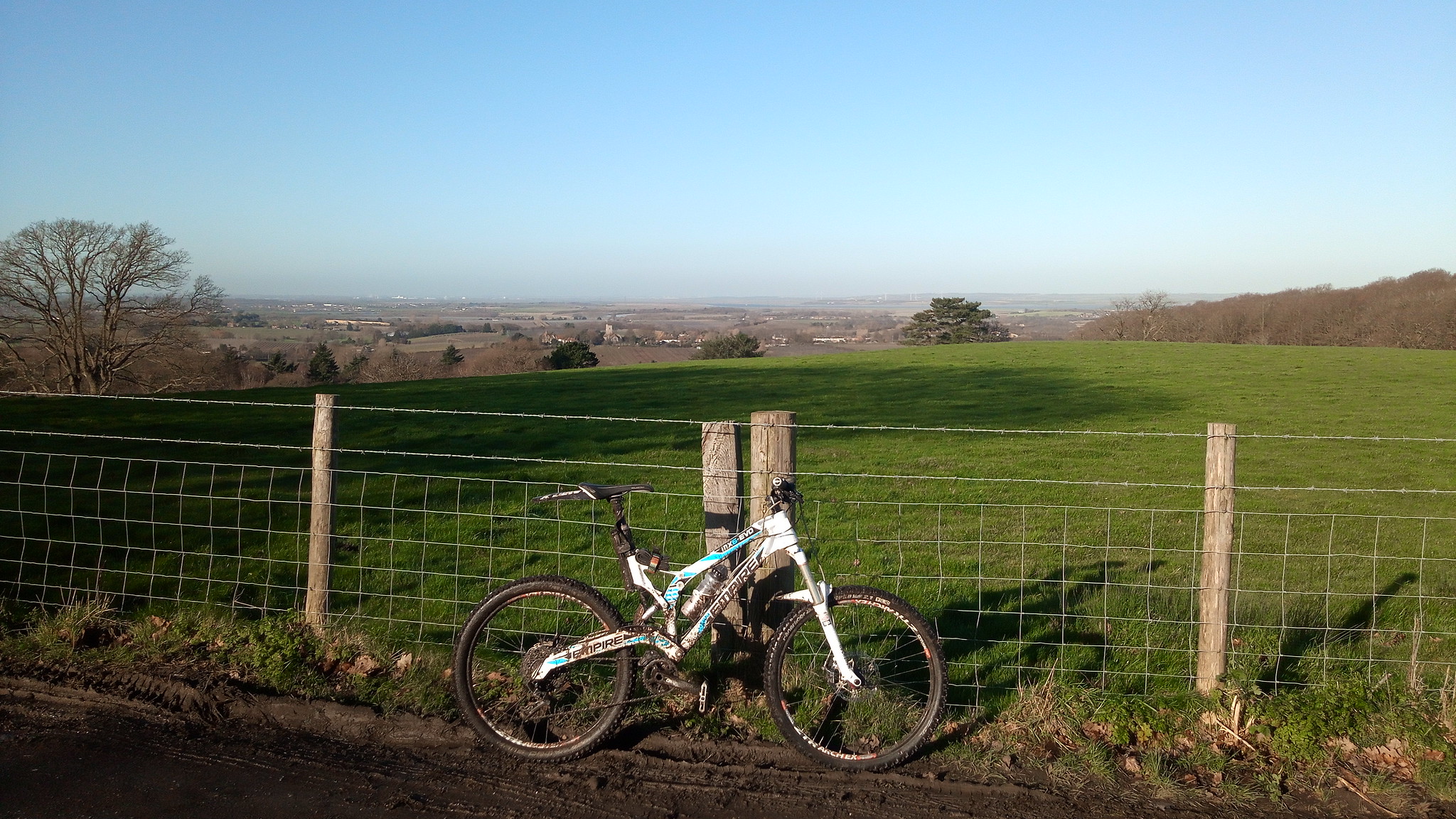
I will make a concerted effort in 2025 to (a) update this blog more frequently, and (b) get more of the byway and bridleway completed.
On a related note, I have made it onto the Veloviewer tilehunting list.
Monday, December 7, 2020
A return to documenting these rides, a p*ss poor show, and I need to keep on top of it.
2020, a review and update on the progress through the year on my self imposed challenge to ride all the byways and bridleways in Kent.
I need to really give myself a kick up the arse to record this properly and capture the details at the time, forgetting the small details after the event is inevitable.
2019 ended with a slow down in riding, fell ill with the dreaded cough/cold for the end of Dec/Start of Jan, on reflection it could have been Covid related, but we'll never know.
So riding resumed on Jan 18th to start filling in the gaps in the map and the trails in the county I have still yet to cover.
I chose Yorkletts country park as the start here, free parking in the small car park, and it has good access.
From Yorkletts it's wet and cold country lanes, left, and south towards Dargate, over the common and onto Denstroude Road, on the right is the entrance to the first bridleway.
This rolls nicely on a gravel surface until the start of the woods proper, then it all turned to crappy mud, and more mud, the leaves and raid and horses made for a shitty slow slog through the mire, out the other side around Bossenden Farm and out onto road. It's one of many trails through Blean woods, well worth a visit (but probably in the better weather).
Slow progress up the hill to Dunkirk, past the village hall, and towards Boughton, on the right opposite Jays Wood is the next bridleway through Clay Pits Wood. It looks like a driveway, but leads to the trail.
This is a great short ride, muddy in the winter but a great sweeping downhill to the road. The view as you exit the woods takes in The Swale over Graveney.
From here at the road junction go straight over onto the next trail, another bridleway over Holly Hill.
Holly Hill has two bridleways, and I've covered the right hand fork previously, the left hand one takes you in a long downhill curve, at this time of year through sparsely covered trees and mud, and out onto the road. I now too the opportunity to grab some missing tiles and took a road section through Graveney and out to the coast, along the coastal path and into Seasalter, there's an odd restricted byway (Sunray Avenue) running through the middle of the town, which needed to be covered.
It runs easterly and out to Joy Lane, then it's a trawl through the traffic and up the hill our of Whitstable, over the A299 and up Clapham Hill on the right, just past Willow Road is the next bridleway.
This one is more grassy and muddy, but a nice trail between hedges, out onto open fields and then onto the small lane at Wraik Hill, left alone the lane to Fox's Cross Road, and onto the trail leading into Ellenden Wood, I've just this section to complete the bridleways through this wood and it proved to be a git, slow and muddy and poorly sign posted.
The beginning is up a grassy, muddy field, well used by horses, and wet, thoroughly bogged. At the top it leads into the woods, and I follow this through and out (via a unmapped shortcut) to the Yorkletts park again, this was also a wet and boggy trail, with plenty of pushing and swearing, but finally back to the car park, to finish, and take stock!!
More trails covered, an incentive to get back out, and some veloviewer tiles taken too.
Thursday, August 15, 2019

Saturday, October 14, 2017
Around Edenbridge, on the Sussex border.
2nd September 2017, a first run around the bridleways near Dry hill.
Looking at the progress I've made so far there was a corner of the county that had not been covered, I'd been around Westerham and Sevenoaks, and needed to get down to south of the Bough Beech Reservior.
We started off at Four Elms, there's limited parking opposite the church but it is free.
Heading north on the B269 to turn right into Mapelton Road, lovely country lane beneath the north downs, continue on this road for roughly 1.2 Km and the entrance to the first Byway is on the left.
The byway runs westerly (through a farm) over to Spout Lane, its a good running farm track.
This winds south west, on a farm track and out onto the road, which we rode westwards, Dairy Lane to Swaynesland Road, we turned left (south) onto Guildables Lane and followed this south to Monks Lane where we turned right, the next bridleway is just on the left here.
It runs as a concrete farm trail down through Bachelor's Farm, there is a junction at Troy Lane and another bridleway continues on the left, take this trail.
This bridleway runs east over to the main road, it has a few gates, and runs through a grass section, getting thinner nearer the road.
Once you appear out onto the B2026, turn left and almost immediately on your right is the entrance to the next bridleway.
This runs down a grassy track alongside horse paddocks and out onto farmland, I have to admit we lost our way a bit here, the signage is a bit bleak, so we took a guess which turned out ok.
The trail loops around to the right and onto Swan Lane, it's ok, and if you want to skip it feel free, the views over the downs are good here though.
We took Swan Lane on the right and back onto the B2026 for a slog through Edenbridge, the ride through the high street is better than the bypass, we've done both and prefer the high street.
Out of Edenbridge following Mill Hill down to the junction with B2028 at Den Cross, this is an awkward right hand turn on a left hand bend, so take it steady.
This is Marsh Green Road, and the starting point of a few bridleways, the first is on the left at Shernden Lane.
This is more of an adopted driveway to be honest, tarmac and a bit of a disappointment, however it does get better (more on a later ride), for our firt foray we turned right onto another bridleway that essentially takes you out onto the road again.
Here we followed the road down to the next bridleway entrance:
This again starts out as a driveway/track and runs down to houses, before leading onto the nature reserve at Dry Hill. (Site of an Iron Age Fort).
We rode a few of these, covering more on a later ride, check out the OS Map, OS Explorer 147 to get an idea of the area, but there are some great trails here, through the woods.
Heading East we rode through Crippenden Manor and out to the road at Spode Lane, then turning left onto Hartfield Road, heading North to Hever and Hever station.
After crossing the railway at Hever, we headed left, then right, down to the river and towards Hever Castle, and turned left onto Hever road, following this for about 800m, until the bridleway entrance on the right.
At the time of riding this was overgrown and full of nettles, giving us a gentle reminder of the joys of bare legs. It's a good trail, crossing the river on a foot bridge and runs for nearly 2km, of singletrack.
This last stretch was back onto the road at How Green Lane, and returning to Four Elms.
The area around Edenbridge and Dry Hill is great for a ride, we could reduce some of our road times by changing our starting point etc, but I'd recommend checking out the trails here.
Tuesday, October 25, 2016
Hardcore around Hawkinge..... another Kent loop out.
Hawkinge, Kent.
Rule No. 9 for this one....if you are out riding in bad weather, it means you are a badass. Period.
Velominti - rules.
It did rain, and rain, and then just when we thought it stopped, it rained again.
Continuing our quest to cover Kent, we had our second route out from Lyminge, this time heading East and down to the Channel Tunnel terminal, around Hawkinge.
From the village hall car park in Lyminge, we headed back through the village and on to Station Road, turning right towards the village welcome sign. On the left is Greenbanks and, between the doctors surgery and the road is a track that is the start of the byway out of the village, this is a steep tricky ride, concrete and old tarmac up to a muddy trail.
(sems popular with motorbikes).
It heads out to the south east between brambles, a good trail, alongside the golf course, you then exit onto Teddars Leas Road, which we followed around to the bridleway start on the right.
(its about 750 yrds, at the Shearins Bungalow site)
A good route, between fields, tree covered and dips down at the end out onto the road. Here we turned right, down towards Peene, its a quick steep descent with a sharp left hander at the end, leading onto the bastard that is Danton Lane.
This road runs alongside the channel tunnel terminal, it was wet now, really pissing down, and quite frankly miserable. But in an odd way I enjoy the crappy weather and my waterproof sock full up with water make for hard pedalling. We took the right hand fork on the junction at the top of the hill onto Crete Road West, this is a great lane, up over the terminal looking out to sea, with the channel a grey squally mess.
Following the lane along further it dips under the main A20 and then out to meet the busy A260 Canterbury road, some rather shifty crossing skills got us over the road.
Crete Road East now climbs at about 12% up onto the cliffs above Folkestone, we follow the road here for half a mile and just past the houses opposite the closed lane on the right, is an unadopted road on the left.
This is according to some maps "Cut Throat Lane", a good ride across open fields (a white lane on OS maps, always a mystery those!), leading down to join the Alkham Valley Road.
By this time my makeshift OS map was getting a bit soggy, so we headed right along the road, to find the next section of offroad.
With the weather still terrible, and quite fun really, we (well I) totally mis-judged the distance and we ended up taking an early exit on Standen Lane, this led us confusingly towards Hawkinge, where I lost my bearing a bit.
However, at the village the sky cleared, I managed to fold the wet map and get it into my pocket, now resembling a tissue after a trip through the washing machine, it would be used only in dire need.
We took another couple of turns through the village missing my intended routes, and taking a cheeky footpath we finally got back on track, the footpath goes through the woods and out past horse paddocks down to a roundabout at Milgate Farm.
The footpath exit brings you out next to the entrance to the cricket club, and we were back on track, taking this lane leads you up and into the woods and onto the next bridleway, at the right hand corner just past the club is the start. This is a lovely trail through Reinden wood, heavy usage by horses, but flat and wide through the woods. We exit at the end of the woods and head out onto the bridle way north east across the fields towards Swingfield.
Onto Boyinton Lane we turned left and followed the road out to the junction with the A260, and onto Reece Lane.
We turned left right heading back on our loop now, onto Hoad Road, following the lane until the next bridleway, at about a mile the road bears to the left and the bridleway is on the right. (the trail straight ahead is a byway).
Here it runs down into a wood to a gate, and then into an open field, up and down a dip and back alongside the woods to the exit on the right, some parts are awkward grass covered tracks.
Out from here onto Ridge Row, we rode straight down to Paddlesworth to join the next off road section. This is another bridleway heading west.
This is another great flowing bridleway between a hedge and fence, down and across a field to a complete mystery, no regular traffic, or signs of horses. walkers etc, so using our best judgement we just headed for what looked like a lane on the far side of the field, it's a shame when this happens and you feel a bit of a failure for not picking up the trail, or working out where it should be.
We found the end......
and then the start of the next one on the other side of the road.
This is our last bridleway over fields heading back to Lyminge, its a good one, grassy and flowing, a few gates to get through and a section through a farmyard and down through a wooded section, there is a nice long downhill section at the end running to the village.
And we're back... despite the weather, it was again great to be out seeing more of the county.
Wednesday, October 19, 2016
Loop out from Lyminge
A Loop out from Lyminge
As the distances to the start of our rides get further away, we’re pushed for time on a Saturday morning to get it done (looking back I can see I've not updated this for over a year, very slack!).
Today we started from Lyminge, (the removal of the “ly” from the village sign is always worth a smirk).
There is free parking at the village hall, which is where we start from.
Heading out from the village hall on the byway at the top end of the car park, its a roughly used small climb on a grassy bridleway. At the crest of the hill it becomes a tree lined singletrack between two open fields, good and flowing down to a gate at the bottom and across a sheep paddock out to the road.
(Sheep shit, the stickest of the shits).
We turned left here for a road section along the Sandling Road, a bit of a drag with some high hedges and traffic, at the junction with the A20 (Ashford Road), the byway entrance is on the right.
byway entrance
The byway now runs west through a wooded section and out into an open chalky surface, and then at the end back to an overgrown doubletrack, its a good diversion. The exit appears out on the road (the B2068).
byway exit
We turned left here heading south (ish), onto Stone Street and through Standford, and take the right hand turn onto Kennett Lane, followed this around and then over to Hayton Road. About 500 yards along the road is the entrance to the bridleway, it looks like (and is) a track to an industrial yard, but the route goes through here and out towards the field.
Bridleway Start.
It takes a few turns and to be honest I think we lost it a bit and ended up on a track out to Swan Lane.
Further down Swan Lane is the entrance to another bridleway which essentially joins the one we lost.
We followed this and took it under the M20, the trail then passes between the M20 and the channel tunnel rail link. You turn right under the railway and out onto an open field, no signpost, and the route is a bit of a mystery.
We aimed for the lonely tree in the middle of the field and rode over towards the farm, which luckily turned out to be the bridleway.
Bridleway at Barrow Hill
You exit the trail on the Ashford Road (A20) and it was a long road drag on the busy A20 to get to the exit for the A261 to Hythe. This is the bottom end of the loop really, and we took this road up the hill, there is an entrance to a Byway on the right, which is a good ride through the woods and out onto farm land, We overshot the bridleway / byway junction and had to double back, the bridleway is on the left hand side and runs diagonal back to the road.
Byway start on A261
This takes you back to the A261 at Oxenden Farm, at Pedlinge, a good farm track. It crosses the road and heads out into the fields, past a chapel, with a rickety wooden gate.
Pedlinge bridleway
This takes you on a nice route through to Saltwood, we lost the bridleway at the end by went through the woods and over the stream and out into the village. A good section with a quick downhill.
Up the hill into Saltwood and we were looking for the castle where our next off road section was due to start, we cocked it up and ended up retracing out steps and heading the right way.
The next trail runs alongside the castle (from Grange Road to Castle Road), the left hand track.
Saltwood bridleway
The trail runs under and old railway down a small valley and then up and out along a fence up to BlackHouse Hill, its a grassy bumpy climb up to the road and gate, but take 5 mins to turn around and see the caslte peer over the tree tops.
Saltwood Castle
A quick dash down the road to the bottom and the next trail starts, I'd take Cliff Road on the left then head up to Sene Park, a rather interesting estate of houses all vying for a sea view.
The climb up from Sene park is a steep rocky trail up to the golf course. There is a small joy riding across the green lawn of the fairway and onto the woods opposite.
Through the woods, out onto open fields and all the way to the M20 on the bridleway, its a good ride, through the MOD camp at Dibgate and onto the Elham Valley way and over the M20.
Our route now takes us up to Peene and onto the old Elham valley railway, a flat gravel trail. It stops sadly, and you have to take a cheeky footpath to get out onto the road again. So we went through Etchinghill and out to the original bridleway back to the car park at Lyminge.
Good ride, great variety of trails and sights, (you can see the sea!).
Subscribe to:
Posts (Atom)